Lifecycle: A lens for rising sea levels | 2016
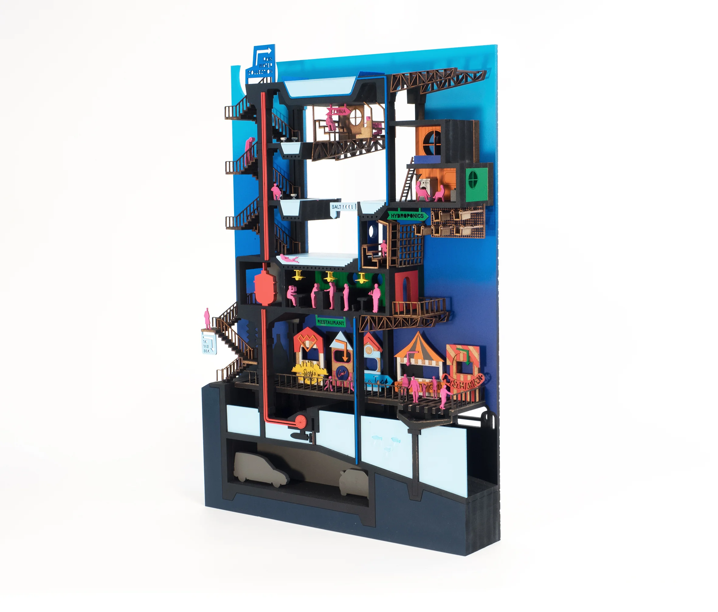
Starting with close analysis of Copenhagen’s urban development over time, the lifecycle of buildings and infrastructure across the city can be estimated by combining 'hard' factors like ownership and 'soft' factors like cultural value. GIS identifies parts of the city at risk from flooding, and neighbourhoods are zoned according to whether they will flood before their built fabric expires, at the same time, or after. It becomes possible to propose an iterative masterplan zoning flood-prone areas for shorter-term, lower value uses like offices, and gradually move homes and their residents inland over time. What new residential typologies become possible?